Horsham District Council recently consulted on its Local Cycling and Walking Infrastructure Plan (LCWIP) which seeks to identity a strategic local cycle network. Our response is shown below.
We think it would be useful to hold a further stakeholder meeting.
Summary
The cycling forum welcomes the publication of the LCWIP as an ‘essential start’ to achieving safer streets within Horsham District, but would like compliance with ‘Gear Change’ and LTN 1/20 to be explicit. We would also emphasise the need for full community engagement in both this document and any subsequent developments. Specific comments about the draft document follow.
General comments:
- This is HDC’s plan; we suggest a forward from the Leader welcoming it.
- The LCWIP is about making Horsham a better place for everyone (not for ‘cyclists’ and ‘pedestrians’) – we suggest the document is re-titled to reflect that: something like Liveable Horsham / Better Streets for Horsham.
- The LCWIP is only a start – to have credibility it is vital to define the milestones for future progress and commit to the next steps in the process.
- Include a commitment to a review date (p17).
- To ensure that new developments do deliver in line with the LCWIP ambitions, it should be given full weight in the new Local Plan (and, when complete, adopted as an SPD). The policies, especially Policy 42, of the draft local Plan need to be strengthened to align with the vision of the LCWIP and with the changes in national policy and guidance since the HDPF was produced (NPPF, Gear Change, LTN1/20, CD195).
- However, an LCWIP is of no value if it does not result in real change on the ground. What actual changes to the network will we see? It is vital to quickly deliver a project of sufficient scale and quality that it can be seen to make a real difference and which can then act as a catalyst for increased public support for further developments extending the network.
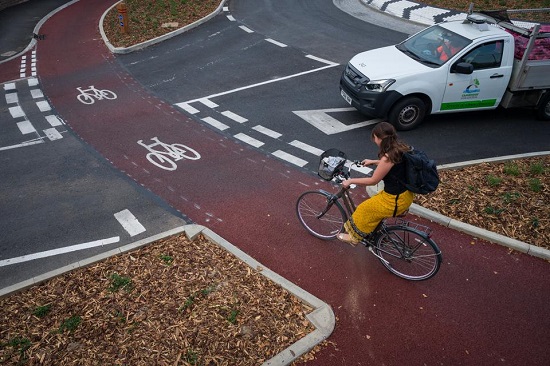
Cambridge’s new Dutch-style roundabout – a UK first (pic: Leon Neal/Getty Images)
Vision, p3
This is a strong and positive vision statement. We propose adding the following to the statement:
“We recognise that a comprehensive, high quality cycle network is essential to achieving this vision. We endorse the principles in Gear Change, the Government’s new vision document and expect all new cycle provision for Horsham to meet the minimum standards of the current Cycle Infrastructure Design guidance (LTN 1/20 and CD195)”.
NB: Government funding is not available for any project which does not meet this standard.
Key outputs
Network map
A network map is a ‘key output’ of an LCWIP, so we propose that one is included in the document. The draft acknowledges that the five shortlisted corridors on p12 in the draft LCWIP draft ‘do not constitute a full cycle network for the plan area’. We think it is essential to continue the work:
- Develop the very schematic network diagram shown on p11 into a map of a complete network.
- Identify, for each of the five initial cycle corridors, feasibly deliverable routes that could meet the 70% Cycling Level of Service target outlined in LTN 1/20 without any critical fails.
- Identify additional routes (needed to connect the five initial radial routes into a functioning network).
‘SMART’ objectives
A ‘prioritised programme of infrastructure improvements for future investment’ is another ‘key output’ of an LCWIP. The draft so far has no priorities, targets, timescales, budgets or commitments to action. We welcome the statement, p5, that ‘it is the district’s intention that each of them is developed and improved’, however we suggest replacing the wording ‘as opportunities arise and funding is available. This however will take many years’ with ‘we will actively pursue opportunities and funding’ and to include priorities and target timescales within the LCWIP.’
Geographic scope, p5
This should be extended to include routes to Crawley, a major employment destination within cycle commuting distance. A safe route has potential for significant daily flows and there is strong community/business support.
Two potential routes to Crawley have been identified: the Missing Link and the A264 corridor (see XXX for summary of route studies, community support). The A264 corridor route is part of WSCC’s Cycling Strategy and LCWIP plans. We request that the Missing Link route is included as part of HDC’s LCWIP.
Strategic cycle corridors, p11
The routes to Warnham and Mannings Heath should be designated as primary routes. Both are within easy cycling distance (current cycle use is low because of road danger) and have established local support.
Warnham route: WSCC has now committed to build the new bridleway with support and additional funding from Warnham Parish (we can provide contacts and further details), so including this in the LCWIP would be an ‘easy win’.
Mannings Heath route: A cycle route to Horsham is included in the Nuthurst Neighbourhood Plan and Nuthurst parish is funding a feasibility study.
Add a cycle link between Southwater and Christs Hospital station (along BP1662/1642).
Add a cycle route from Broadbridge Heath and Wickhurst Green, along Mill Lane bridleway and the Downs Link to Christ’s Hospital station.
Integration with Policy and Strategy, p6
Under “Alignment with National Policy” add Gear Change and Cycle Infrastructure Design (LTN 1/20).
Add CD195 – this is a relevant standard for provision along and across the A264 and A24 which fall within geographic scope.
Town Centre, p 47
We feel this section is a major weakness – a ‘black hole’ – in the LCWIP. All 5 routes stop short of the town centre.
We agree that “A range of measures are required to enhance cross-town cycle routes”, but the Horsham Town Centre Public Realm Strategy, May 2020 does not address these issues and they need to be an integral part of the LCWIP.
The town centre is absolutely crucial for connectivity:
- It contains the highest density of destinations and is a vital node for cross town trips.
- A key feature of cycling as a transport mode is the advantage it offers over car or public transport in providing door to door transport. If it is not possible to cycle directly to destinations, such as town centre shops, this advantage is lost.
- Good cycle networks support local shops and businesses because it is more convenient to cycle from shop to shop than to park the car and walk across town carrying shopping bags.
Horsham Park: any improvements made for Park Run, may also be adaptable to improve cycle routes through the park.
Equality Act 2010
The draft has no mention of provision for disabled users who are particularly sensitive to poor standards of provision. Under the Equality Act 2010 there is an obligation to make ‘reasonable adjustment’.
Issues of especial significance to disabled users include removal of (motorcycle) barriers on paths, lower vehicle speeds, separation from cycles, crossing design, removal of steps, slopes.
Engagement with a range of disabled and older users is especially important to ensure that changes meet their needs.
Destinations
Add primary schools as destinations – these are priority destinations for a walking and cycling strategy, even more so since covid.
The whole of north Horsham is currently shown as a single destination. This ignores the railway which splits the area in two. The cycle network needs separate provision for trips to the east and to the west of the area’s railway line.
Political Leadership and Public Engagement
Experience from elsewhere shows that the key to success is political commitment to deliver along with strong public engagement from the earliest stages – see examples below.
Cycling schemes are not difficult from an engineering point of view; they are also cheap and excellent value for money compared with other roads infrastructure and good cycling schemes always have a high level of public support. The biggest hurdle to delivering the LCWIP is likely to be a lack of understanding and therefore fears about, for example, longer car journey times, loss of parking, pollution, road safety, wasting money etc – this applies to varying degrees within the various councils, stakeholder groups and the general public.
We think that increased and ongoing public engagement will be vital: not only does local knowledge improve design, but it develops community level understanding and support for the council’s plans which is vital to prevent and counter opposition.
Good engagement develops buy in and can create effective community champions.
We would like engagement to avoid an atmosphere which encourages a ‘for/against’ atmosphere or the sense that there is a vote to be won or lost. Instead, we would like to see more of a discussion of the pros and cons of alternative options with ideas being refined and improved.
We think it is essential to go out and meet local residents, businesses, stakeholder groups (parents at schools, older people’s groups, disability groups, young people, residents’ associations…).
Leaflet the local area.
Use online engagement tools like Commonplace and Widen My Path – which are now widely used and have resulted in unprecedented levels of engagement and efficient use of officers’ time.
Continue public engagement during and after construction: it is an opportunity to mitigate any problems and to keep moving forward (i.e. improving schemes rather than being diverted into arguments about removing them).
Engagement examples from elsewhere:
- Faversham Town Council’s 20mph speed limit project: the council have done a really good job of keeping the local community involved throughout the project by regular updates, engaging with residents and visitors on the street, as well as using Commonplace to record comments.
https://20mphfaversham.commonplace.is/
- In preparing their LCWIP, Crawley did an online survey (and hard copies to reach those not online), they used the Commonplace software tool for public comments and they trained local volunteers in route audit to help with the workload.
Low Traffic Neighbourhoods
We welcome the mention of LTNs in the draft, p31, but there are no positive plans for these and the Elm Grove-Forest School area that is discussed is too small to function as a full LTN.
Since the draft LCWIP was written, government support for low traffic neighbourhoods has increased through the LTN 1/20 and Gear Change policy documents and the Covid investments. They are cheap and are highly effective for walking, cycling, for residents and for local businesses.
We suggest that the first LTN should be bounded by Comptons Lane, Brighton Road, Harwood Road and North St. This would benefit Forest and Millais schools, routes to the railway station and would enable an alternative north-south low traffic route from Brighton Rd to the Tesco Express/Crawley Rd roundabout avoiding the hostile North St railway bridge.
Other areas within the town for LTNs and school streets are Blackbridge Lane area (benefitting Arunside and St John’s Schools and removing the speeding, collisions etc created by use of Blackbridge Lane as a cut through) and the Trafalgar area (benefitting Trafalgar and Greenway schools and the heavy use and collisions that result from Rushams Rd being used as a cut through).
Circulation Plan
The five strategic routes already identified, plus further other routes will need to use some relatively narrow and currently heavily trafficked distributor roads. Along much of the length of these there is not enough space for two-way motor traffic together with protected cycle tracks. A joined-up network cannot be delivered without a circulation plan for motor traffic.
Costs, p16
The physical build costs shown should also mention the benefits of investing in cycling and walking e.g.
- Boosting the town centre: walking and cycling improvements can increase retail spend by up to 30%.
- Reducing absences and increasing productivity: people who are physically active take 27% fewer sick days each year than their colleagues.
- Wider economic benefits: investing in walking and cycling can save billions of pounds worth of health and environmental damage.
In the context of road building and parking costs the sums in the LCWIP are not large eg £164m for the M23 smart motorway changes, £8m+ for Piries Place car park, £3.5m for M23 junction 11 road widening at Pease Pottage etc. The government places a value of around £2m on preventing a singleroad death of around £2m and preventing a serious injury is worth around £200,000.
Can we afford NOT to invest in cycling and walking?
Additional thoughts:
- HDC Corporate Plan – This is likely to be adapted due to covid financial pressures. Is it possible to change wording in the Plan to be more favourable towards cycling and walking?
- North of Horsham – the LCWIP does not cover this. Although to some extent the area should be covered by the north of Horsham cycling strategy (which is still not complete/approved), it needs to be part of the LCWIP which is meant to be a long term plan. The current proposals for North of Horsham need to be updated to meet LTN1/20. We welcome the proposal that pedestrian and cycle provision on the A264 bridge should be segregated.
- Progressing schemes – The document needs to address how HDC will progress schemes to a point that puts them in a good position to win support from WSCC (not necessarily ‘shovel ready’, but on the way there, especially in terms of a political green light).
Walking
The LCWIP needs further work on walking provision.
Generally, the extent of Horsham’s walking network (mainly footways) is good. There are some missing links in the network (such as at the North St/Albion Way junction) and some issues with the standard of maintenance but the key strategic network issue is meeting Cycling Level of Service audit and adhering to the current design standards.
We would like to see a commitment in the LCWIP to:
- More pedestrian crossings, more direct crossings, reduced pedestrian wait times at traffic signals, grade separation at major junctions (across the A24 and A264), separation from cycles on crossings (parallel crossings), side road zebras.
- Removal of pedestrian guard rails (which are primarily used to enable motor vehicles to travel faster.
- Removal of pavement parking.
- 20mph speed limits.
- Footway provision in new developments except in ‘home zones’ where traffic flows are very low and speeds are extremely low (5-10mph). NB A recent example of lack of footway provision is Borrer Drive, Henfield.
- Continuous footways across minor side roads.
- Attention to the quality (level) and placement of dropped kerbs.
- Use of ‘entrance kerbs’ at vehicle crossovers to maintain a flat, level footway across drives etc. Improved service level standards for maintenance of the surface of footways, control of vegetation and for winter de-icing.
For more information see the TfL Planning for Walking toolkit.

Speak Your Mind