Fine weather on Saturday 3rd October created ideal conditions for around 25 people to ride Horsham’s brand new east-west cycle route and see for themselves where £320,000 of Local Sustainable Transport Fund money has been spent.
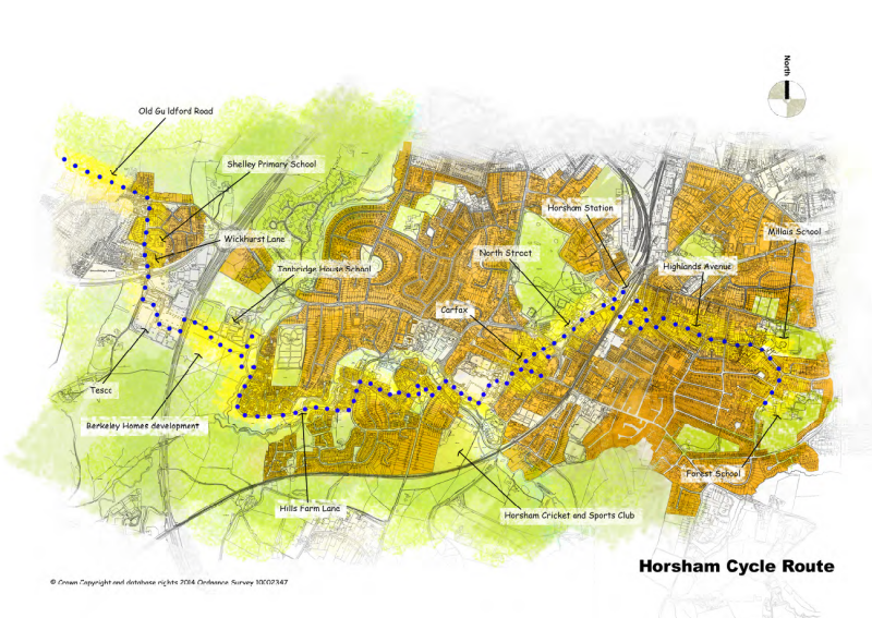
LSTF east-west cycle route
Executive summary
For people to use a cycle route it must be safe, convenient, direct and attractive. It must connect people up with the places they want to go: schools, businesses, shops, leisure facilities, places of worship etc.
However, most people will not be following the route in its entirety. They will “dip in” to the route, using short sections of it to get where they are going. The route must therefore allow people to get on and off the route easily. The route should form part of a larger network of high quality routes.
There are very few measures taken on the route that would actually encourage anyone to cycle who doesn’t already do so.
The design, such as it is, adheres to the obsolete “two tier” approach where it is assumed that less confident riders will be happy to take a tortuous slow route. Recent research confirms however that it is precisely the less confident riders who are likely to be deterred by indirect and slow routes.
There are some minor improvements (a few dropped kerbs, some repositioned barriers etc.) and two new contra-flows but the route essentially consists of large numbers of blue signs on posts.
Issues identified along the route included:
Lack of connectivity
There is a lack of connectivity to the destinations on the route. No effort has been made to link up with schools along the route, such as Arunside and St John’s, or provide convenient access to the Tesco store at Broadbridge Heath.
There are no links to Horsham Park or to the Pavilions leisure centre, despite the route passing very close to two of the most popular destinations in the town to reach by bike.
Lack of directness
From Broadbridge Heath to Forest School is 3 miles on foot or by car, yet to follow the signed route by bike takes you over 4 ½ miles. Research has shown that the people who most need quiet routes away from traffic, such as women and children, are the very people who will be most deterred by having their journey lengthened.
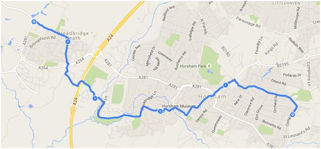
Broadbridge Heath to Forest School … the long way round
Lack of continuity
The route is not continuous. One rider commented that it was the “walk your bicycle” route. There are two significant gaps in the route: at the North Street subway and on the westbound route through the Carfax, where you are expected to get off your bike and walk. In addition there are far too many places along the route where you have to give way, often where visibility is poor.
At numerous locations, existing barriers have simply been replaced with brand new barriers aligned slightly differently. On a well-designed cycle route barriers should very rarely be needed. This continuous starting and stopping is far more of a problem on a bike than when walking. Enabling people to maintain momentum is one of the basic requirements of bicycle-friendly design.
Lack of cohesiveness
The route is confusing. There are numerous places where signs are missing, unclear or even pointing in the wrong direction. Anyone attempting to follow the route for the first time would get hopelessly lost.
Frequent comments on the ride were: “Where does the route go?”, “Where are the signs?”
Despite this, overall the route has far too many signs. Users are overwhelmed with information (some of it duplicated).
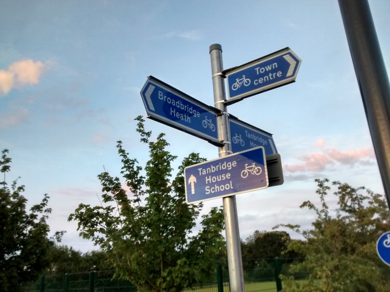
Direction signs and route confirmatory signs, both on the same post
This signpost is one of several examples where there are both directional signs and route confirmatory signs, both giving the same information. The directional signs are sufficient here. Route confirmatory signs should only be used along the route, not at junctions.
Many of the signs on the route are placed on new poles, some of which are positioned right next to existing lampposts which would have been perfectly suited for the task. It some cases the lamppost even offers a better siting then the new post! In either case the new posts create unnecessary street clutter.
It should be possible to coordinate this, especially when works such as lamppost replacements are being done at the same time as installing new signs, as was the case in Horsham recently. We’ve been told that this is difficult since the works are done by different contractors, but since the work is all being done for the Council it should be possible to coordinate this. Other local authorities seem to manage this sort of thing perfectly well.
Poor quality of work
Problems with the surface of the route have not been addressed: for example the existing very worn cycle lanes have not been repainted and overhanging vegetation has not been cut back – even where it obscures brand new signs.
On-road cycle lanes do not meet the minimum guidance widths and transitions (e.g. from road to footway) and corners are abrupt and have bad visibility.
Cllr Morwen Millson joined us for the start
Morwen Millson, County Councillor for Horsham Riverside, met us at the start of the ride outside Forest School.
Writing after the event she said:
“I am grateful to the Forum members for giving up their time to cycle the new cross-Horsham cycle route. This will help the County Council identify features that work well and those that could be improved.”
David Skipp, District Councillor for Horsham Park joined us for the entire route and Nigel Dennis, County Councillor for Horsham Hurst met with Forum members at the post-ride discussion in the Conservatory Café in Horsham Park.
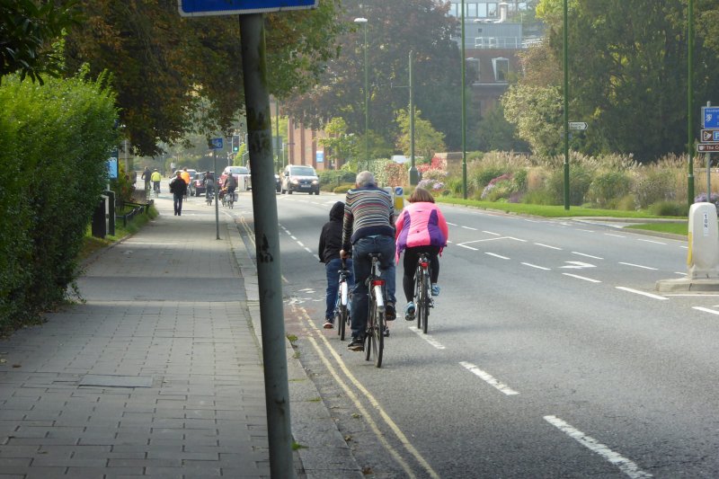
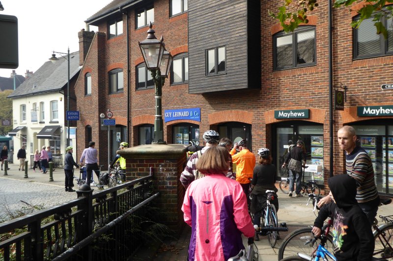
Riding the route on North Street
Lessons learned meeting
We have secured a “lessons learned” meeting later in the year with Highways officers, and both District and County Councillors.
County Councillor Morwen Millson said:
“I am particularly keen that the council gets good value from scarce resources for sustainable transport. I hope to see a post implementation meeting between the Council and the Horsham Cycle Forum to promote this learning. Saturday’s exercise will help ensure that any future schemes maximise the benefits and provide the best possible value for money.”
Many people who were riding the route for the first time were genuinely surprised at the issues we encountered. One commented: “It feels like whoever designed this route has never ridden a bike along it.”
Other comments included:
“It’s a bit of a treasure hunt trying to follow the twists and turns.”
“The route on Saturday was a complete and utter joke and I cannot imagine anyone would want to use it.”
“We should press WSCC to mark the cycle way as they do on the road – a green band on the route to enable cyclists and everybody know that ‘this is a designated cycle route’.”
“WSCC should get assistance from someone who knows about cycling.”
Snagging list
We have been asked by WSCC to produce a “snagging list” of minor issues (missing signs, poor surfacing etc.) which need resolving. If you have anything you would like to see added to the list please contact us on info@hdcf.org.uk.
UPDATE 15/10/2015: A snagging list has been sent to WSCC which can be viewed here. It should be noted that this is not a list of all the problems with the route, but simply a list of issues which affect the use of the route and can be easily and cheaply corrected. The more major issues with the route are outlined in this article.
Starting from Forest School
At Forest School it is unclear where the cycle parking is located. A seamless connection with the cycle parking at the school should have been worked out with the school authorities.
Right outside the school is the first of many unnecessary signs.
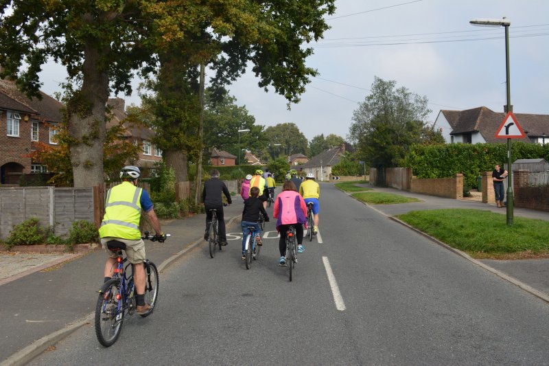
Starting out on the ride
Between Comptons Lane and Winterton Court the route essentially follows the road. No measures have been taken to make the route safer or more suitable for people on bikes.
The crossing with Orchard Road remains hazardous. No improvements have been made. One mum who rides along this section commented that this is a very dangerous road at school times.
The junction priority at the right turn into Highlands Avenue has not been changed and remains hazardous, especially given that this section of the route is used by children from the two nearby schools.
These roads are narrowed as a result of parked cars along both sides and are highly congested during school hours.
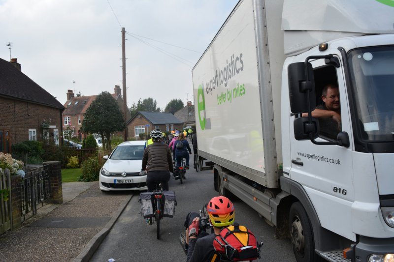
Traffic jam on Highlands Road – it’s even busier during the school run!
David Skipp commented:
“The turn from Highlands Road into the Avenue is tricky and needs resolving by highways.”
Route to Horsham station not signed
From Oakhill Road there are no signs indicating the route to the station.
The only signage to the station at this point directs you (wrongly) up Barrington Road (and is marked as pedestrian only).
Oakhill Road – How do we get to the station?
There is good cycle parking at the back of the station and the Cycle Hub (which was installed as part of the LSTF scheme) provides spacious and easy-to-use cycle parking. It should however have been sited at the front of the station where people actually want to park their bikes.
There are no signs from the rear of the station directing you back onto the route.
On Winterton Court there are no signs to indicate where the path goes. For anyone not familiar with the route the most obvious direction is either down Hampshire Court or continuing on Winterton Court.
Instead of being removed, old metal barriers have just been replaced with new ones. A bollard would be a less intrusive option here, both for cyclists (who have to walk their bikes at this point) and for pedestrians.
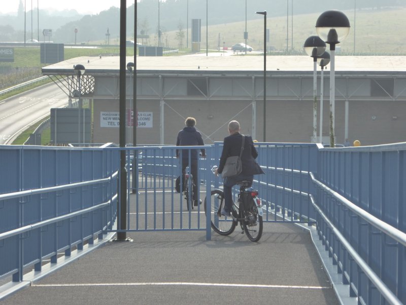
There is a 200 metre gap in the cycle route at this point. Dismounting your bike here involves a two minute walk. For anyone cycling to the station this is an unacceptable delay.
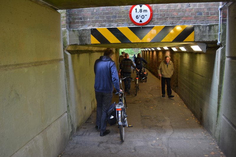
North Street subway – having to get off and push
Poor access to the station
Cycle access to the station from the North Street subway involves a circuitous route on a busy road. There should be direct access from the east-west route, either through the car park or alongside the railway line. There is plenty of space, for example where there is currently an overgrown grass verge in the car park.
North Street/Chart Way
Where the path exits onto North Street there is a new dropped kerb and central island which makes it easier for pedestrians and cyclists to cross the road, but just a few extra metres of path could have created a link to the cycle paths in Horsham Park, a popular destination for families on bikes.
The transition to the jug handle on the northbound lane is very abrupt. Apparently a lack of coordination with the contractors meant that a new lamp column was put in just where the jug handle was due to be built.
North Street jug handle during construction
Outside the Black Jug the northbound cycle route rejoins North Street on a blind bend. There is plenty of space (where there is a semicircle of setts) to avoid this.
The on-road cycle lanes on North Street were repainted three times during the project, but still have not been reinstated to the full original width (which was itself already below the minimum width given in official guidance).
On Chart Way all the signs indicating that cycling is allowed have been removed. There needs to be some indication that cycling is allowed here, for example small shared use roundels at regular intervals on the brickwork.
David Skipp said:
“Chart Way is wonderful to cycle over but needs more warning for pedestrians that there may be people cycling.”

Chart Way – “wonderful to cycle over” but needs clear signage
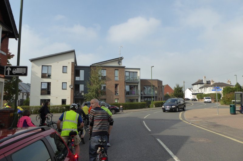
Carfax
On the approach to the Carfax there is no indication where the route goes. Going westbound there is a gap in the route at this point and riders are expected to dismount and walk their bikes across to Market Square. This is a major failing of the route.
Confusion in Carfax – Where do we go here?
There is no link to the cycle racks in Medwin Walk.
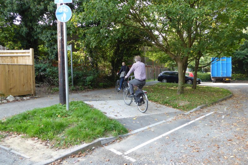
There is a welcome new contra-flow in Copnall Way although the entrance to the contra-flow is very narrow and awkward, despite the space available by the wide footway and derelict flower bed.
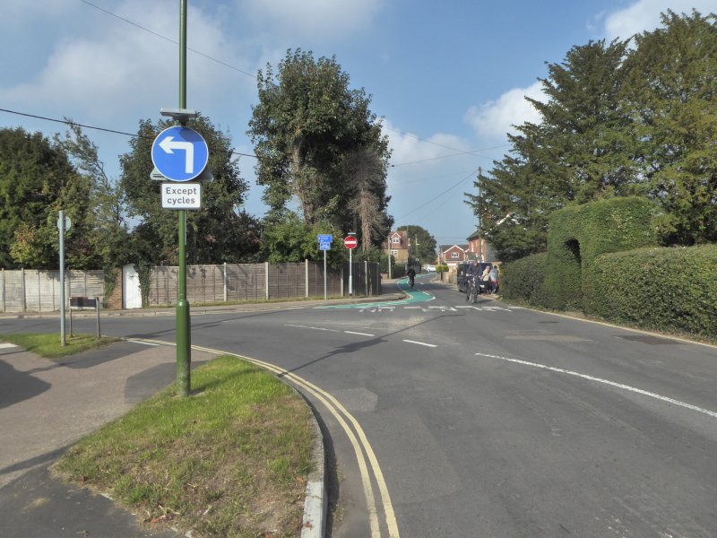
At the entrance to East Street from Carfax there needs to be an “Except cycles” sign under the No entry sign to indicate that contra-flow cycling is allowed on this section.
There are no signs either on South Street or on East Street indicating where the route continues.
There is already excessive street clutter which should have been removed from the northwest corner of the Old Town Hall (Bills restaurant) and this has now been added to by the unnecessary new post for the cycle route signs. The direction signs for the cycle route would have been better placed on the existing street furniture. The deep gutter across the path at this point is very jarring to ride across.
Cars are frequently parked across the route at the back of the Old Town Hall despite the double yellow lines. The cycle route needs to be clearly marked on the road here (as has been agreed).
The short spur path from the Causeway to Furneaux Walk has been sympathetically widened and provides good access to and from the path.
The Cyclists Dismount sign at the western end of Furneaux Walk needs to be removed.
Sainsburys
Behind Sainsburys there is a sharp and narrow right turn where the surface has become badly potholed: this needs to be improved.
Sharp bend behind Sainsbury’s – poor surfacing
Many of the barriers on the route have been angled and moved back. Although these “Horsham barriers” slightly reduce the conflict between cyclists and pedestrians, they are still unnecessarily large and restrictive and in most cases should have been removed or replaced by a single bollard.
“Horsham barriers” – angled, set back and slightly better than before
Worthing Road
Although the large number of Cyclists Dismount signs have been removed, the cycle path on shared-use footways is still very fragmented with confusing tactile paving, poor visibility and potential conflict with pedestrians. It offers no benefit to cyclists who are already on the Worthing Road.
The cycle path gives way to a very minor side road at River Mead.
Tanbridge Park
It is good that the old wall at the entrance to the Tanbridge Park cycle path has been removed but, instead of removing all the metal barriers, they have simply been rearranged and continue to confuse and obstruct both pedestrians and cyclists.
There has been no change to the Worthing Road entrance to the southerly cycle path into Tanbridge Park, which remains virtually invisible to cyclists approaching from the road.
Blackbridge Lane
On the exit from Tanbridge Park the dropped kerb onto Blackbridge Lane allows people on bikes to access the road more easily but the exit onto the road needs to be wider to reduce potential conflicts with other path users. This area gets very busy at school times.
Visibility to the left when exiting onto Blackbridge Lane is obscured by a high wooden fencing panel on the piece of waste land to the left of the path. This panel should either be removed or lowered to improve visibility.
The jug handle on the opposite side of the road is of very limited use because it gives way to a minor side road (Arunside). The wide verge here could have been used to provide a separate cycle path for children at Arunside and St John’s primary schools.
Hills Farm Lane
The path from Tanbridge House School to the bridge over Boldings Brook is a more useful route for a high proportion of users. It could easily have been incorporated as a spur to the route. The Cyclists Dismount signs should be removed (as previously agreed). A wide, clear path to Guildford Road could have been provided.
Highwood
The route across the Boulevard bridge is useful, but there is no need for cyclists to be directed onto the pavement where the shared-use path stops without warning.
On the Boulevard the more direct route would be through the car park (as was on the original plan). This entry point should be reinstated so as to avoid the awkward section through the new housing estate. See Notes on direct route through Highwood for more details.
The path around the Tanbridge House School site has a smooth wide surface but the route is circuitous with a high fence, blind corners and encroaching vegetation. This path was being designed and built during the LSTF project and the opportunity to improve the design was missed.
The ramp on the western side of the new bridge over the A24 has two sets of barriers, which are awkward for people on bikes as well as creating conflict between cyclists and pedestrians. The bottom set of barriers has a metal strip across the path just at the point where you are having to turn sharply to negotiate the barriers. This will be slippery when wet.
Awkward barriers on the A24 bridge ramp
The hairpin bends at the bottom of the ramp are awkward to negotiate and there is not enough room for cyclists and pedestrians to pass each other.
Once you have left the ramp, cycle access takes you a long way away from the entrance to the store. There is no obvious way to access the Tesco store (other than by picking a route through the car park).
Tescos
The route follows the existing cycle path through the Tesco site. This section is unsigned. The path is intermittent and of poor quality, has several sharp bends and Give Way lines and is poorly maintained. There is rubbish and overgrowing vegetation obscuring the path in places. There is no signed access to the Tesco store from either the bridge or the subway.
One rider commented that there should be markings on the road to indicate where the cycle route goes.
At the crossings by the road entrance to the Tesco site there are no signs indicating where to go. There is a multitude of zebra crossings with no cycle provision whatsoever.
At the entrance to the A264 subway there are no signs indicating that the route follows the subway and not the path at ground level.
As you approach the western end of the subway there are no signs indicating that you need to be on the right side of the barrier in order to cycle up the exit slope onto Wickhurst Lane. Lane markings are very worn and have not been repainted, although this was specifically mentioned in the scheme description.
Broadbridge Heath
At the exit from the subway a dropped kerb has been installed but at approximately 18mm it is still higher than the recommended maximum of 6mm.
When coming back east, at the southern end of Wickhurst Lane the new sign (on a new post) telling you to take the subway is positioned where it is completely obscured by a tree. The sign should have been installed on the existing lamppost where it would not be blocked by the tree.
Wickhurst Lane
On Wickhurst Lane there is an awkward right turn at the Church Road junction. The layout of the cycle lane for the contra-flow is poor and puts cyclists riding along the road at risk. There is a confusion of signs with five separate signs in two locations.
The “official” route seems to be to turn sharp left before the junction and mount the pavement on the left, stop and look over your shoulder (awkward since you have to turn almost 180 degrees) and then cross the road at the widest section whilst keeping an eye out for traffic coming from the left and from down Church Road at the same time.
There needs to be an “Except cycles” sign under the No entry sign on the entrance to Wickhurst Lane.
Church Road crossing – confusing and dangerous
At the junction of Wickhurst Lane with Old Guildford Road the wide flaring on the junction at the crossing has not been addressed: the layout of the cycle lane is poor and the crossing remains hazardous.
The cut through on Old Guildford Road should have taken the more direct route along the road rather than forcing cyclists onto the narrow pavement. There is already a path (through the trees behind the parked lorry shown in the picture below) which could have been widened.
Old Guildford Road – Why squeeze cyclists onto the pavement?
The western start of the route has been signed from the roundabout on the A281.
Picture credits: Alex Ingram, Mark Treasure, Peter Silburn, Ruth Fletcher
More pictures from the ride can be viewed here and here.
The wider picture – Cutting the Cycling Officer post was a false economy
Being awarded this funding was a great opportunity to build the kind of bold new routes which are now starting to make a real difference in places such as Brighton, London, Bristol, Walthamstow and Leicester.
However, WSCC cut the post of Cycling Officer shortly before the project commenced. The council was left without clear leadership or the technical expertise to manage the tendering process, brief the designers, consult with the public, coordinate with those working on plans for several other developments which were also taking place along the route, check the safety and quality of the final design and to drive the project through. The route has fallen far below the original objectives.
All but the most minor changes to the road have been avoided. Instead, large sums have been spent on “soft” measures such as the poor quality cycle racks, maps and an excessive number of blue route signs. Despite this, we were told in March this year that there was still a projected underspend of about 45%. In other words there is another £140,000 that could have been used on real changes to make the route safe for cycling, but which now seems to have been lost.
With the right staff on board WSCC would have been able to make good use of all the money it was given. Horsham could now have an attractive new cycle route which would have brought more shoppers and visitors to the town centre. It would be helping reduce congestion and pollution and improve people’s health as well as giving children and those without cars the ability to get around quickly and cheaply.
For more details on how we got to this state please read Following the money: Where is Horsham’s cycling money actually going?
See also The politics of funding – an evening with Roger Geffen MBE.
Notes on direct route through Highwood
The route through the car park is as per planning application DC/10/0006. This is currently the site of a temporary car park given permission under DC/11/1100 until September 2014. However, despite being made aware of this by the Forum, no plans were produced to take advantage of the direct route when the permission lapsed. The developers made a subsequent application to extend the use of the car park to 1st September 2017 and this was granted unopposed (DC/14/2306).
Measures should be taken to use the direct route when the temporary permission runs out in September 2017 so as to avoid the awkward section through the new housing estate.
The direct route is through here:
The Boulevard – direct (original) route to the cycle path
As indicated on the original drawings:

The Boulevard – direct route on the original plans

How thoroughly depressing. I have to agree with all your comments.
A very comprehensive write up of our cycle ride. Have to agree with a lot of the points. It is a disappointing end to what could have been something good.
As a user of part of the route in and out of town I find my own short cuts… there is also a missed opportunity to get from New Street to Queen St (Brighton Road) without going down to the suicidal exit onto Brighton Road. I use Livingstone Road and Park Terrace East. Need a contraflow for the last bit! An under-used road which could easily take that.
Sorry I can no longer make meetings as already committed on Tuesday evenings.